Real-Time Kinematic (RTK) Global Navigation Satellite System (GNSS) technology is transforming precision in various engineering fields, including construction, land surveying, and agriculture. This technology enables professionals to achieve centimeter-level accuracy in geographical data collection and analysis, significantly enhancing operational efficiency. However, while RTK GNSS is often heralded as a breakthrough, underlying complexities and challenges deserve attention to understand its true capabilities and limitations.
The Intricacies of RTK GNSS Technology
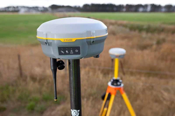
At its core, RTK GNSS provides real-time positioning by utilizing signals from satellites orbiting the Earth. A base station sends corrections to a mobile GNSS receiver, facilitating accurate positioning. This precision makes RTK GNSS a vital tool in high-stakes industries requiring detailed mapping and measurements, such as land surveying and autonomous vehicle navigation.
Despite its advantages, achieving such precision is not merely a matter of activating equipment. Engineers must navigate a range of factors that can affect RTK GNSS performance, including satellite availability, atmospheric conditions, and local interference. These challenges can complicate the accuracy that engineers often showcase in ideal scenarios.
Challenges of Satellite Availability and Environmental Factors
One notable challenge is satellite availability. RTK GNSS relies on a robust network of satellites to deliver accurate positioning data. In densely populated urban environments, tall buildings can obstruct or reflect satellite signals, leading to inaccuracies commonly known as the “urban canyon effect.” This phenomenon can severely impact RTK GNSS performance, particularly in metropolitan areas where reliable signal reception is essential.
Atmospheric conditions also play a significant role in RTK GNSS accuracy. Variations in the ionosphere and troposphere can cause delays in the satellite signals. Although RTK systems are designed to compensate for some of these delays, extreme weather conditions, such as heavy rain or solar activity, can exacerbate the issue, affecting signal clarity and reducing accuracy.
Engineers often emphasize the ideal conditions for RTK GNSS systems, yet these real-world factors necessitate careful consideration to ensure optimal performance.
Infrastructure Requirements and Cost Implications
The effective use of RTK GNSS also depends on a well-established infrastructure. Base stations are crucial for transmitting correction data to mobile receivers, ensuring accurate measurements. The density and quality of these base stations directly affect the reliability of the RTK GNSS system. In rural or remote areas where base stations are sparse, additional infrastructure may be required, such as satellite-based correction services or local reference stations. This need for expanded infrastructure can increase the overall cost and complexity of implementing RTK GNSS systems.
Moreover, the continuous maintenance of these systems is often overlooked. Technical oversight is necessary to ensure that base stations function correctly and maintain effective communication with mobile units. For users without direct access to these infrastructures, maintaining accurate positioning can become a significant challenge.
Cost considerations present another critical aspect of RTK GNSS technology. Despite becoming more accessible, the financial investment for these systems remains substantial. Expenses can accumulate, encompassing the costs of base stations, correction services, software, and ongoing maintenance. For smaller projects or organizations with limited budgets, this financial burden can be prohibitive.
Beyond initial setup costs, users may encounter the need for specialized training and potential infrastructure upgrades, further complicating the financial landscape of RTK GNSS implementation. As a result, while RTK GNSS offers remarkable accuracy, it may not be feasible for every sector, particularly where precision is not the highest priority.
As the field of RTK GNSS continues to advance, understanding the technology’s limitations becomes increasingly important for professionals across various industries. Acknowledging challenges such as satellite availability, the necessity for robust infrastructure, environmental influences, and cost considerations will enable engineers to maximize the benefits of RTK GNSS while preparing for potential obstacles in real-world applications.
In conclusion, while RTK GNSS technology is a powerful asset in engineering, a comprehensive understanding of its complexities is essential. By recognizing these intricacies, professionals can ensure they utilize RTK GNSS effectively, harnessing its precision while navigating the challenges inherent in its application.
Alexia Hope is a technology journalist at Research Snipers, where she covers the latest developments in technology, including major players like Google and Apple.