UPDATE: A powerful winter storm is wreaking havoc across New York City and the Tri-State area as of February 22, 2026. Heavy snowfall, strong winds, and life-threatening cold are prompting blizzard warnings with forecasts predicting up to 17 inches of snow in NYC and potentially two feet in surrounding regions. This storm is shaping up to be one of the most severe in recent years.
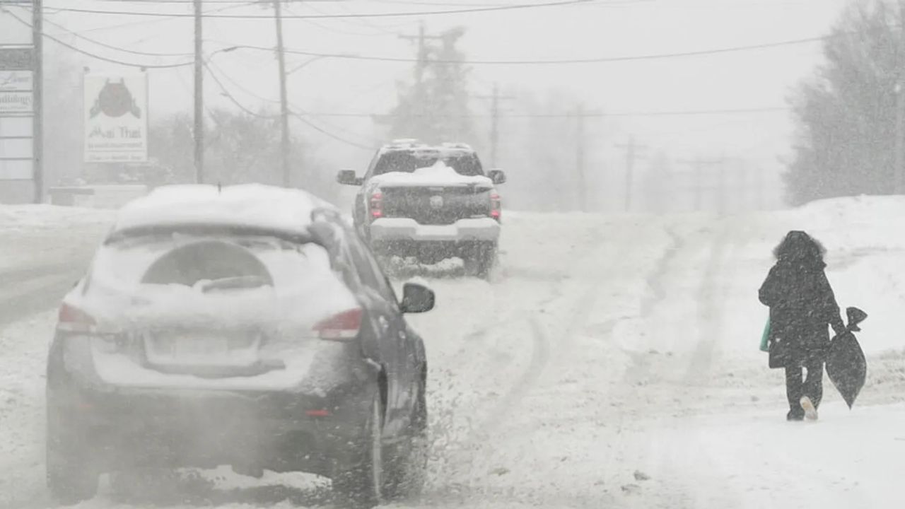
The National Weather Service warns that heavy, wet snow is falling at rates of up to 2 inches per hour. Coastal areas, including Long Island and the I-95 corridor, are expected to experience a dangerous transition to sleet and ice. Wind gusts are reaching up to 70 mph, creating near-blizzard conditions with low visibility and whiteouts likely to persist through Monday.
Temperatures have plummeted below freezing, creating dangerous “feels-like” conditions that could drop below 0°F. These Arctic temperatures are colder than any sustained period seen in NYC over the past eight years. Wind chills are expected to reach life-threatening levels overnight.
Blizzard warnings are in effect for NYC, New Jersey, Connecticut, parts of Pennsylvania, the Hudson Valley, and southern New England, with the NOAA’s Winter Storm Severity Index indicating substantial to extreme impacts. The heaviest snow accumulations—over 12 inches—are forecast for areas east and southeast of I-95, from Philadelphia through NYC to Boston. Coastal regions face higher risks of sleet and ice, leading to potential power outages.
**Estimated Snowfall and Risks:**
– **NYC Core:** 6-17 inches, whiteouts, heavy snow rates
– **Long Island / Coastal NJ:** 6-12 inches, sleet mix, icy roads
– **Hudson Valley / Inland CT:** 12-24 inches, blizzard conditions
– **Philadelphia to Boston:** 12+ inches, extreme impacts, flooding
In response to the hazardous conditions, DoorDash has suspended operations in NYC until at least Monday at 10 a.m.. NYC’s Code Blue is active, ensuring shelters remain open 24/7 during this cold snap. Widespread closures of schools, medical facilities, workplaces, and major transit services—including subways and flights—are already in effect, with mass cancellations reported at local airports. Monday commutes are expected to be “extremely hazardous.”
Tragically, at least five New Yorkers were found deceased outdoors prior to the peak snow, highlighting the vulnerabilities faced in extreme cold. The storm’s severity is drawing comparisons to the devastating Great Blizzard of 1888, which resulted in nearly 400 deaths and travel paralysis, underscoring modern risks such as infrastructure strain and prolonged sub-zero temperatures.
As power outages from ice and high winds continue to rise, emergency states have been declared in New Jersey. Residents are urged to avoid travel, stock essential supplies, and heed local alerts. NYC Emergency Management is emphasizing precautions against hypothermia, as plowing operations prioritize major arteries but may leave side streets treacherous.
This high-impact storm is evolving rapidly, demanding vigilance through Monday as snowfall tapers but the cold persists, threatening to rival historic events in disruption. Stay informed through official channels to minimize risks and protect your safety.