UPDATE: The Bay Area is bracing for another wave of rain today, January 8, 2024, as weather forecasters warn of persistent precipitation. This storm is expected to last into the night, bringing light to moderate rain and potential flooding in various regions.
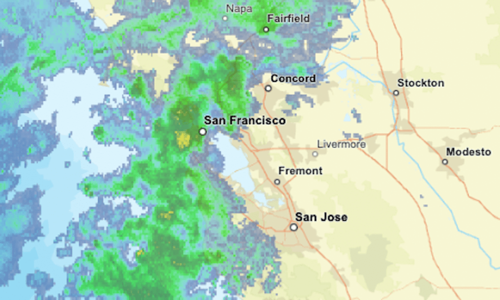
The latest radar indicates current rainfall across the Bay Area, with areas marked in yellow and orange signifying heavier downpours. Residents are urged to stay alert as minor flooding has already impacted some cities, creating hazardous conditions on local roads.
In addition to heavy rain, the Lake Tahoe area is anticipating light to moderate snowfall. A winter storm warning is currently in effect for the Northern Sierra Nevada, Mount Shasta, and the Siskiyou range, where forecasters predict heavy snow and high winds, potentially disrupting travel and outdoor activities.
As this storm system moves through, residents can expect a transition to drier and colder weather later this week. However, the immediate focus remains on navigating the wet and potentially dangerous conditions today.
Authorities advise drivers to exercise caution, especially in areas prone to flooding. Monitoring local weather reports and staying informed about changing conditions is crucial as the storms continue to develop.
This ongoing weather pattern highlights the challenges faced by communities across California, which have already been grappling with recent flooding and high tides. The impact of these storms on daily life is significant, prompting emergency services to prepare for potential evacuations in vulnerable areas.
Stay tuned for updates as conditions evolve throughout the day. Residents are encouraged to share their experiences and any weather-related issues on social media to keep the community informed.