UPDATE: A powerful storm is unleashing dangerous winds exceeding 100 mph across the Rockies, Midwest, and Northeast, prompting urgent safety warnings. The storm, which has already wreaked havoc in Colorado, is moving eastward, with high winds expected to affect millions by Friday evening.
Residents in the Rockies have already experienced gusts of 102 mph at Berthoud Pass, Colorado, with winds in the region reaching between 90 and 100 mph. Over 750,000 utility customers are currently without power as downed trees and power lines have caused widespread disruptions.
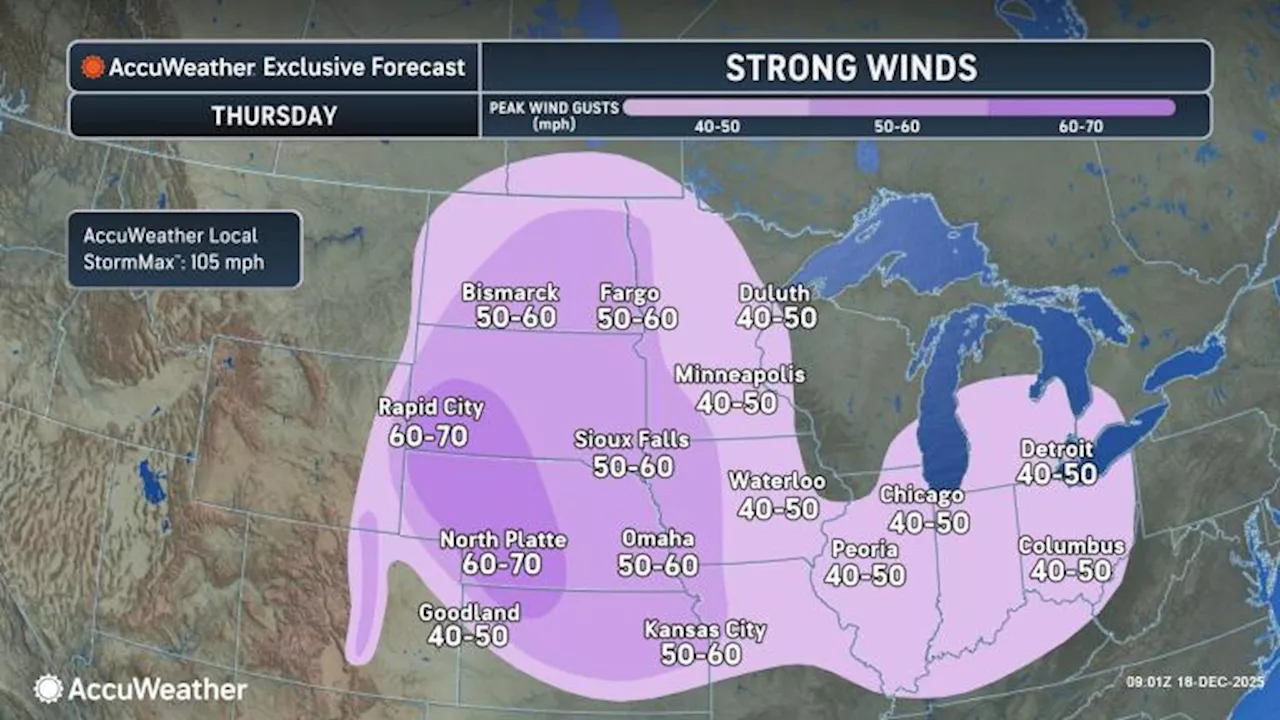
As of Thursday night, the storm will shift from the Midwest into the Northeast, where winds may not be as intense but can still lead to sporadic power outages and airline delays in major hubs. The Ohio Valley and Great Lakes are also bracing for gusts of 40 to 50 mph, raising concerns for coastal flooding along the Atlantic as winds shift.
This latest weather system is expected to bring additional storms to the interior West from Thursday night into Friday night, with gusts likely reaching between 50 and 80 mph from Montana to Colorado. AccuWeather has forecasted a peak gust of 110 mph in mountainous areas, raising alarms for potential property damage and hazardous driving conditions.
Local authorities are urging residents to prepare for the worst as conditions may lead to blizzard-like whiteouts in northern Plains areas. Utility companies may resort to temporary power shutdowns to mitigate wildfire risks as dry conditions persist across parts of eastern Colorado and New Mexico.
Travelers are advised to stay updated on potential flight cancellations, especially at Denver International Airport, where winds could lead to significant disruptions. Ski resorts in the region may also face temporary closures due to unsafe conditions.
The storm’s impact is expected to be felt widely, affecting communities and infrastructure across the Midwest and Northeast. Officials are monitoring the situation closely and advising residents to remain vigilant as conditions evolve rapidly.
Stay tuned for updates as this developing story unfolds.