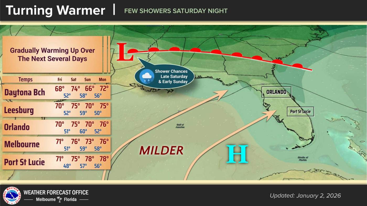
UPDATE: Central Florida is experiencing a significant warm-up today, with temperatures expected to reach around 70°F as the chill of the new year fades. The National Weather Service (NWS) in Melbourne reports that overnight lows will rise to the upper 40s, creating a stark contrast to the colder temperatures seen earlier this week.
Residents can expect dry conditions throughout the day as high pressure moves east across the Florida peninsula. Light westerly winds will accompany the warmth, with gusts potentially reaching up to 20 mph in some areas north of I-4.
As we move into Saturday, the warming trend continues before a cold front approaches from the Southeast U.S. This front is forecasted to bring scattered showers overnight into Sunday, with conditions expected to shift significantly.
Friday night will see increasing cloud cover ahead of the front. Overnight lows are projected to dip into the mid 40s in rural areas south of I-4. The NWS noted, “Southwesterly flow increases locally ahead of the front, with available moisture rising through the day.”
On Saturday, highs will climb to the mid 70s, but conditions will begin to change as the cold front moves in. Early forecasts suggest that while temperatures will drop slightly on Sunday, they are not expected to plummet drastically. Most areas will remain in the 70s, with northern regions potentially dipping into the upper 60s. Overnight lows will settle in the 50s.
Looking ahead to next week, temperatures are set to rise again, with highs reaching the upper 70s to lower 80s by Thursday. Coastal locations are expected to experience overnight lows in the lower 60s, maintaining the warmth.
Stay tuned for updates as this weather system develops. Residents are advised to prepare for the potential rainfall and adjust plans accordingly. This is a developing story; we will continue to provide updates as more information becomes available.
For now, enjoy the warmth while it lasts, and prepare for the changes that the weekend will bring.