UPDATE: A significant cold snap is sweeping across Alabama tonight, plunging temperatures into the 30s and 40s as the work week begins. This sudden chill is accompanied by rain in some areas, particularly in northeast Alabama, marking a stark contrast to the warmer temperatures anticipated later this week.
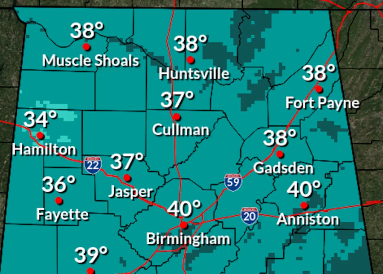
The National Weather Service has confirmed that tonight’s temperatures will drop significantly, with lows expected to hit the 30s in northern Alabama and the low to mid-40s in the southern regions. Frost is likely for many areas, especially in the north, impacting morning routines for residents.
For those in northeast Alabama, today presents the best chance for rain, while much of the state remains dry. Highs will struggle to reach the 50s as clouds linger overhead, making it a particularly chilly Sunday.
After this brisk start to the week, warmer conditions are set to return by midweek, with temperatures soaring back into the 60s and 70s. By Friday, forecasts suggest highs could even touch the 80s in parts of southern Alabama, a welcome relief for those looking to escape the cold.
As the week progresses, the weather service predicts no significant rain until at least Friday, with only slight chances for the northern part of the state. This forecast promises to bring a dramatic shift, as many Alabamians prepare for a much warmer weekend.
Looking ahead, the Climate Prediction Center indicates a high probability for above-average temperatures from November 9-15, especially in western Alabama, where the odds stand at 50-60 percent.
“Residents should prepare for a chilly night, but warmer days are just around the corner,” stated a representative from the National Weather Service.
Stay tuned for ongoing updates as the weather evolves, and ensure you’re prepared for both the cold snap tonight and the warmth expected later this week.